Cerro Escorial (Cerro Escorial)
Cerro Escorial is a stratovolcano at the border of Argentina and Chile. It is part of the Corrida de Cori volcanic group and its youngest member. A well-preserved 1 km crater forms its summit area. Lava flows are found on the Chilean and smaller ones on the Argentinian side, the former reaching as far as 3 - 4 km from the volcano. One of these is dated 342,000 years ago by argon-argon dating.
Off the western coast of South America, the Nazca Plate subducts beneath the South America Plate. This process has given rise to the Andes mountain chain and the Altiplano-Puna high plateau, which formed through shortening of the crust that lasted until 1 million years ago. Cerro Escorial rises from the Puna, which is dissected at Cerro Escorial by the Archibarca lineament; it is a strike-slip fault that has facilitated the ascent of magma.
Andesite lavas were erupted during the Miocene and Pliocene. Hydrothermal alteration has affected an area 4 km from the crater. A Plinian eruption on Escorial was the source of the dacitic Escorial ignimbrite, which is also known as the Corrida de Cori ignimbrite or Caletones Cori ignimbrite. Pulsed changes in the magma supply during the eruption generated a radial ignimbrite structure which was deposited in various flows. The source magma underwent significant crustal contamination and contains quartz veins, indicating that the ignimbrite interacted with a buried hydrothermal system. Lithic clasts including basement material are also present. The ignimbrite has a volume of about 0.6 km3 and was erupted 460,000±10,000 years ago. The eruption of the ignimbrite was followed by more lava eruptions and the formation of a Holocene cinder cone. Present-day activity is of hydrothermal nature and the absence of infrastructure and human population in the region mean that renewed activity is unlikely to have an impact.
A sulfur mine lies 4 km southwest of Escorial. Mining ceased about 1983.
* List of volcanoes in Chile
* List of volcanoes in Argentina
Map - Cerro Escorial (Cerro Escorial)
Map


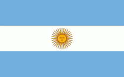
Country - Argentina
 |
 |
| Flag of Argentina | |
The earliest recorded human presence in modern-day Argentina dates back to the Paleolithic period. The Inca Empire expanded to the northwest of the country in Pre-Columbian times. The country has its roots in Spanish colonization of the region during the 16th century. Argentina rose as the successor state of the Viceroyalty of the Río de la Plata, a Spanish overseas viceroyalty founded in 1776. The declaration and fight for independence (1810–1818) was followed by an extended civil war that lasted until 1861, culminating in the country's reorganization as a federation. The country thereafter enjoyed relative peace and stability, with several waves of European immigration, mainly Italians and Spaniards, radically reshaping its cultural and demographic outlook; over 60% of the population has full or partial Italian ancestry, and Argentine culture has significant connections to Italian culture.
Currency / Language
| ISO | Currency | Symbol | Significant figures |
|---|---|---|---|
| ARS | Argentine peso | $ | 2 |
| ISO | Language |
|---|---|
| EN | English language |
| FR | French language |
| DE | German language |
| GN | Guarani language |
| IT | Italian language |
| ES | Spanish language |